Go West: Lincoln losing steam; leaves behind a saturated Gulf country
Ex-Cyclone Lincoln is Western Australia-bound but persisting with its mission to keep tracts of north western Queensland and the Northern Territory waterlogged.

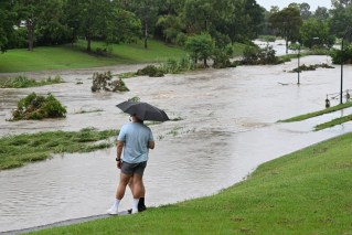
A supplied satellite image obtained on Saturday, February 17, 2024, of ex-Tropical Cyclone Lincoln moving across northern Australia. Ex-Tropical Cyclone Lincoln will continue to bring rain and flooding to the NT and Queensland over the coming days. (AAP Image/Supplied by Bureau Of Meteorology)
Isolated thunderstorms and scattered to widespread showers are forecast across Queensland’s Gulf Country, North West, Peninsula and North Tropical Coast on Monday.
There’s also a high chance of rain and thunderstorms with heavy falls and possible damaging wind gusts in the Northern Territory’s Barkly, Gregory and northern Tanami Districts.
At the other end of the nation, the NSW central and southern tablelands were also bracing for severe thunderstorms late on Sunday generated by a humid and unstable air mass along the Great Dividing Range.
Locally intense rainfall was forecast by the Bureau of Meteorology across central eastern NSW with a warning area stretching from Coonabarabran south to Canberra with the possibility of large hailstones and flash flooding.
Almost 30mm of rain fell in as many minutes at Orange Airport shortly after noon on Sunday.
Conditions are expected to ease into Tuesday but rain is likely to continue at least into the middle of the week, particularly in the state’s east.
Lincoln is meanwhile tracking west across the Top End, with concerns it could redevelop into a cyclone off the northwest coast of Western Australia midway through the week, the bureau said on Sunday.
Along the way, heavy, locally intense rainfall and damaging wind gusts have visited upon a number of remote communities including Tennant Creek, which received more than 138mm of rain in the 24 hours to 9am on Sunday.
Now a tropical low, Lincoln is expected to reach the Kimberley on Monday.
However, major flood warnings remain for western Queensland on the Diamantina, Nicholson and Flinders rivers.