Brisbane cops an early drenching; woman drowns in NQ as cyclone looms large
A woman has died after her car became submerged in floodwaters as northern Australia braced for another cyclone and torrential rain sparked flood warnings in south-east Queensland.
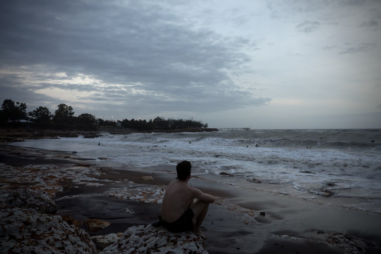
Surfers take to the water as storms sweep across the top end resulting in wild surf rolls at Nightcliff beach in Darwin, Wednesday, January 17, 2024. (AAP Image/Neve Brissenden) NO ARCHIVING
Emergency services responded to reports of a car spotted in the flooded Malbon River at Duchess in Queensland’s northwest after 1pm on Thursday.
A 28-year-old woman was located inside the vehicle and declared dead.
The northwest is still reeling from flooding caused by the remnants of ex-Tropical Cyclone Kirrily as the region braces for more wild weather.
A tropical low is set to move southwest towards the Northern Territory, cross the Gulf of Carpentaria coast and move onshore on Friday afternoon.
It has a 40 per cent chance of becoming a cyclone on Friday, the Bureau of Meteorology said.
A cyclone warning has been issued for Gulf coastal areas from Port Roper in the NT to Burketown in Queensland’s northwest.
The cyclone will be named Lincoln if it forms, the Bureau of Meteorology said.
Winds up to 100km/h and isolated falls beyond 200mm may impact the cyclone warning area, prompting vulnerable residents to be evacuated.
In the NT people have been relocated from the Beswick community south of Katherine while more than 60 residents have been evacuated from Burketown.
Communities across Borroloola, Groote Eylandt and Mornington Island in the NT are set to be affected by the tropical low even if a cyclone does not develop.
“It’s now getting within that closer proximity of land, and probably not quite have enough time (to develop into a cyclone),” the bureau’s Patch Clapp said.
“We are seeing severe weather effects regardless of whether it’s called a cyclone or not, right along that Gulf coast.”
Winds of 75km/h are already being felt in the coastal areas of the NT’s McArthur River region.
Burketown has already recorded 135mm of rain in the last 24 hours but the bureau said totals of up to 250mm are possible.
The region is bracing for what would be the third cyclone in as many months this season.
Queensland’s northwest is still reeling from widespread flooding caused by ex-cyclone Kirrily which crossed the coast just weeks ago.
And Tropical Cyclone Jasper caused record flooding in Queensland’s far north in mid-December.
“Many of these areas have had major flooding in the past couple of weeks associated with ex-tropical cyclone Kirrily,” meteorologist Angus Hines said of the cyclone warning region.
“In a number of these spots particularly in north Queensland the floodwaters are still easing from the last round of flooding.
“Of particular concern are the Doomadgee and Burketown regions where many roads are closed and communities are still isolated – further flooding is a possibility in those hard-hit regions.”
Flood watches are current for Queensland’s northwest and for the NT’s Daly and Katherine Rivers.
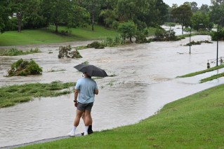
Queensland’s southeast has also been lashed with heavy rain on Friday, bringing flash flooding.
There were widespread falls in excess of 100mm overnight, with Rosalie recording 197mm in the last 24 hours.
Brisbane and Bowen Hills have recorded 135mm in the same period, and 148mm inundating Mount Cootha.
The SES has already received about 60 calls for help across the state from midnight on Friday, with almost 50 in the southeast region alone.
Severe storms have produced heavy rainfall in south-east Queensland, particularly Brisbane which recorded more than 80 millimetres in two hours.
The Bureau of Meteorology (BOM) said 181 millimetres of rain was recorded in the Brisbane suburb of Rosalie, 175mm in Mt Coot-tha, 162mm in Brisbane, and 154mm at Toowong.
A severe weather warning for heavy rain remains in place for parts of Ipswich, Gold Coast, Brisbane and Redcliffe.
Meanwhile in the state’s north, the Bureau of Meteorology said the tropical low had a “moderate” chance of developing into a cyclone.
Communities across Borroloola, Groote Eylandt and Mornington Island in the NT are set to be affected by the tropical low even if a cyclone does not develop.
“Whether or not this intensification occurs we still anticipate areas of strong winds and heavy rain across parts of north Queensland and the Northern Territory,” the bureau’s Angus Hines said.
Gale-force winds up to 100km/hr are set to hit the region by Friday afternoon.
In the coming days, daily widespread rain of 50 to 100mm is expected with isolated falls of 150 to 200mm.
“We could even see rainfall totals above and beyond that particularly around far northwest Queensland around the coast of the Gulf,” Mr Hines said.
Flood watches are current for northwest Queensland.
“Many of these areas have had major flooding in the past couple of weeks associated with ex-tropical cyclone Kirrily,” Mr Hines said.
“In a number of these spots particularly in north Queensland the floodwaters are still easing from the last round of flooding.
“Of particular concern are the Doomadgee and Burketown regions where many roads are closed and communities are still isolated – further flooding is a possibility into those hard-hit regions.”
Residents on Groote Eylandt in the Gulf were already reporting heavy rain and wind gusts on Thursday, with flood warnings also issued for the Katherine River.
In the NT people have been evacuated from the Beswick community south of Katherine, while residents in Burketown in Queensland were also airlifted out.
The state’s Gulf region is still reeling from widespread flooding caused by ex-cyclone Kirrily which crossed the Queensland coast weeks ago.
Tropical Cyclone Jasper also caused record flooding in the far north in mid-December.