‘This is not a drill’: Jasper such a threat that even weather station has evacuated
Staff at a remote weather station may soon be evacuated as Queensland braces for an unusual tropical cyclone.

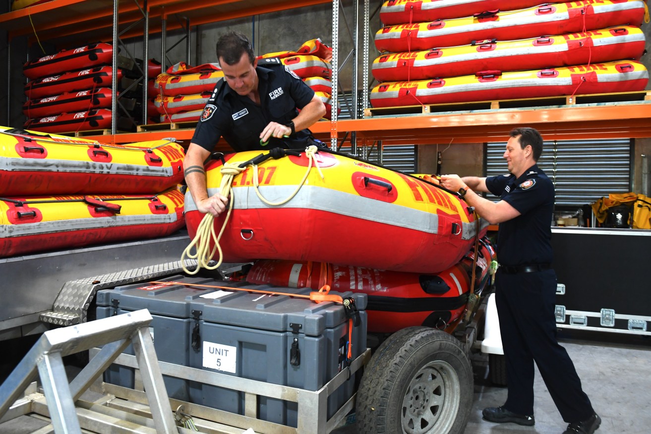
Fire and Rescue officers prepare swift water rescue boats) AAP Image/Jono Searle)
Tropical Cyclone Jasper intensified into a category 4 system on Friday and is now on track to impact the north Queensland coast between Cooktown and Townsville by mid-next week.
The large system’s current course has sparked contingency plans for the bureau’s Willis Island station, located about 450km off Cairns in the Coral Sea.
Four staff members are set to be evacuated, with the station now in Cyclone Jasper’s reach.
“In terms of our Willis Island crew, we are putting in firm plans to look at what we do with them over the coming days, with decisions to be made on them over the course of today,” the bureau’s Dave Grant told reporters.
A bureau spokesperson told AAP the remote station was built to withstand a category 5 cyclone but staff safety was the priority.
Jasper is set to weaken over the weekend but is expected to intensify again into a severe tropical cyclone as it approaches the north Queensland coast next week.
A cyclone watch – a warning issued when impact is expected within 24 and 48 hours – could happen as early as Sunday.
“There is still a considerable amount of uncertainty [about] how strong and where the system will track over the coming days,” Mr Grant said.
Emergency Services Minister Mark Ryan urged Queenslanders to be prepared and mindful of warnings as the unusual cyclone approaches.
The system is the first tropical cyclone to form in Queensland waters in December in an El Nino year.
“It’s unusually early for Queenslanders,” Mr Ryan said of Cyclone Jasper’s arrival.
“Cyclones can obviously have devastating impacts on community, property and life.
“This is not a practice. This is not a drill. This is the real deal … continue to pay attention to authorities.”
Jasper was about 1200km east northeast of Cairns at 9am (AEST) on Friday and moving south across the Coral Sea at 10km/h.
Heavy rainfall is expected along the central and north Queensland coast from Monday with flood watch alerts possible.
Severe heatwave conditions current in the far north and southwest are set to ease as the cyclone approaches next week.
“Tropical Cyclone Jasper is quite a large system,” the bureau’s Laura Boekel said.
“Which means that it does have quite a lot of cloud bands associated with that, bringing showers, rain and thunderstorms.”Jasper looks set to bring heavy showers across Queensland, not just the immediate area it impacts.
“We could definitely see rainfall ranging quite far out from where that core of that cyclone is,” Ms Boekel said.
“Quite large areas could see severe storms as well as rainfall that could produce flash or riverine flooding.”
The state disaster centre has now been moved to alert level, Queensland Police’s Acting Deputy Commissioner Shane Chelepy said.
Preparations are in place with local and district disaster coordinators spanning Mackay to Cairns.
Cairns is preparing for king tides of up to almost 3m from Tuesday to Sunday next week that may be exacerbated by the cyclone and prompt storm surge evacuations.


