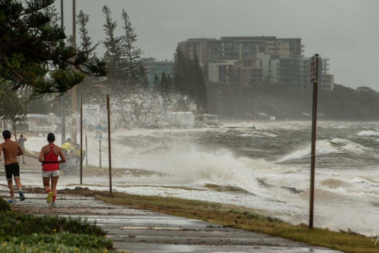
After the deluge … plenty more wild weather on the way for soggy southeast
Queensland’s extreme weather is set to worsen today, with the Bureau of Meteorology expecting heavy rain, damaging winds and the possibility of flash-flooding from Bundaberg down to the New South Wales coast.

Redcliffe Peninsula was hit by rough seas over the weekend. (Photo: Supplied: Glenn Bell)
Emergency Services Minister Mark Ryan has warned of the cyclone-like impact of the extreme weather event and said residents must prepare for the worst.
“Many of the impacts from this weather event will be similar to a category-one cyclone event,” he said.
Across the state, Energex crews have been working to restore power to some 7200 homes, mainly at Bli Bli on the Sunshine Coast and at Redland Bay.
While there have so far been no SES call outs on the Gold Coast, just across the border in Tweed Heads, SES Unit Commander Christine McDonald told ABC Radio Gold Coast they have been very busy with around 120 callouts over the weekend.
“It’s been a busy couple of days since Saturday. We’ve had crews out with flood assist, leaking roofs, trees down … we did have one flood rescue — mostly though, it’s been fantastic,” she said.
Queenslanders have been warned to stay off the roads, avoid unnecessary travel and to never drive through floodwaters.
Queensland Fire and Emergency Services Commissioner Greg Leach said residents need to have plans in place in case of flooding.
He said extra swiftwater rescue teams have been organised to be available today as a precaution.
“What we’re seeing is a significant change in the weather pattern in Queensland,” he said.
“Only last week we were dealing with bushfire situations and now the big wet has arrived … and so we need to be prepared not only for the weather we are dealing with now but we’re likely to see over the coming month.”
An eastern trough has dumped hundreds of millimetres of rain between the Fraser Coast and the New South Wales border over the past three days.
Overnight, the highest totals fell on the Gold Coast and Sunshine Coast, with 186mm recorded at Upper Springbrook and 188mm received at Maleny.
More rain is expected to fall all along the southern coast for the morning though, and the severe weather warning remains in place.
The surface trough is expected to start contracting towards the southern border this afternoon, meaning conditions will ease on the Sunshine Coast while remaining relatively heavy on the Gold Coast into the evening.
The flood watch remains for the coast from Fraser Island to the border, with a minor flood warning current for the Logan and Albert Rivers.
The severe rain comes as good news for bushfire ravaged Fraser Island, which will reopen to the public tomorrow after a blaze that had been burning since mid-October was contained.
The Queensland Fire and Emergency Service handed operation of the incident back to Queensland Parks and Wildlife yesterday.
From Tuesday, accommodation providers can welcome guests, vehicles will be permitted on the eastern beach, access will be granted to the townships and camping spots opened up.
Queensland Parks and Wildlife deputy director-general Ben Klaassen said while the fire has not been completely extinguished, Fraser Island is now safe to visit.
“The island is starting to regenerate — there’s green shoots already coming through,” he said.
“Overall the fire is under control and we are expecting the recovery to get underway now.”
Some fire-affected areas and walking tracks will still be restricted for safety reasons.
– ABC / © 2020 Australian Broadcasting Corporation. All rights reserved.


