Six of the best: Massive storm front set to unleash rain, hail on south-east
A series of dangerous storms with the potential to unleash flash flooding, coin-sized hail and destructive winds have formed over southeast Queensland.

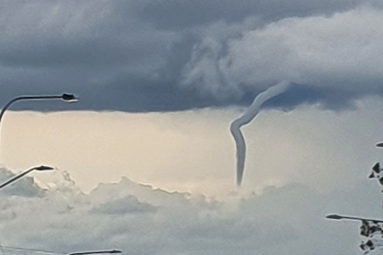
A cold-air funnel formation seen near Warwick (pic Carmel Farrell)
Six severe thunderstorms were pushing southeast towards Warwick, Toowoomba, the Lockyer Valley and Kilcoy, the Bureau of Meteorology says.
“These storms can also become very dangerous with supercell development possible,” meteorologist Rosa Hoff said.
“We could potentially see isolated (rainfall) totals of 100mm if we see a particularly large storm go through.”

The thunderstorms also have the ability to whip up other wild weather, such as oversized hailstones, flooding and big winds.
A remarkable cold air funnel has been spotted over Warwick, south-west of Brisbane, Tuesday afternoon as severe storms moved east across parts of southern Queensland.
⚠️#Severe Thunderstorm Warning – #SEQld updated ⚠️
A severe thunderstorm near #Caboolture is producing very heavy rain which may lead to flash flooding. 80mm already recorded at Caboolture. See warnings: https://t.co/yUSREFtOVl pic.twitter.com/zHzfckQrVJ— Bureau of Meteorology, Queensland (@BOM_Qld) October 27, 2020
The Bureau of Meteorology (BOM) has issued a severe thunderstorm warning for people in parts of the Gympie, Somerset, Scenic Rim, South Burnett, Noosa, Sunshine Coast and Moreton Bay council areas.
At about 3pm, a series of storm cells were moving east across the southern inland, impacting Nanango and Kilcoy.

A funnel-shaped cloud near Killarney (photo Carmel Farrell, via Channel 10)
“We could see damaging winds in excess of 90 km/h and large hail that has a diameter larger than 2cm – bigger than a $2 coin,” Hoff said.
“Or potentially, even heavy rain that could lead to localised flash flooding.”

A Bureau of Meteorology warning issued this afternoo0n showing six storm cells over southeast Queensland. (Photo: Supplied/Bureau of Meteorology)
Hoff said the worst of the weather was expected on Tuesday afternoon and into the evening.
“As we track forward into tomorrow, the increased chance of seeing severe storm development does move closer to Brisbane,” she said.
Queensland Fire and Emergency Services have warned people to move their cars under cover and secure loose outdoor items.


