Jasper weakens as it crosses NQ coast: From nine-day reign of fear to just rain
People have been rescued from rising floodwaters as Tropical Cyclone Jasper weakens to a tropical low after hitting the Queensland coast.
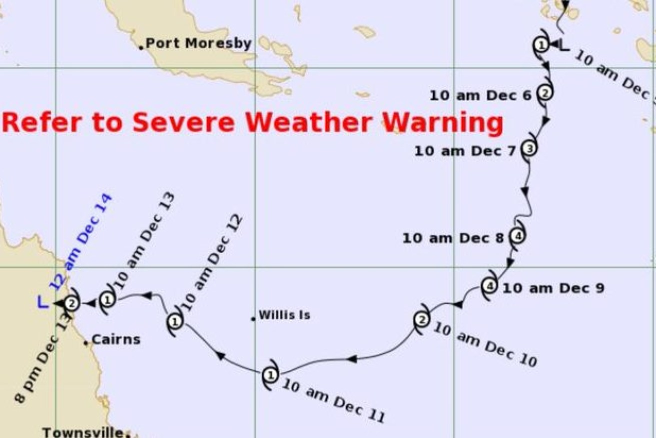
After three weeks of slow progress, Cycline Jasper has downgraded to a tropical low. (image: BoM).
The season’s first cyclone made landfall as a category 2 system near Wujal Wujal, north of Cairns, on Wednesday night, bringing destructive winds of about 100km/h and heavy rainfall.
The system was downgraded to a tropical low overnight, however, intense showers, thunderstorms and damaging wind gusts are set to continue in the north as it moves inland on Thursday.
People were forced to flee their homes as trees were uprooted and power lines damaged with up to 300mm of rain causing flooding.
More than 43,000 houses and businesses are without power, Ergon Energy said.
People at Mossman had to be rescued from their homes early on Thursday, more than 100km from where the system came ashore.
“We had eight people who had to be evacuated, then we did have to do some door knocking to advise people of rising floodwaters,” a far northern Queensland Fire and Emergency Services spokesperson told AAP.
“Some chose to leave their homes and seek shelter at the Mossman library, others chose to stay at home.”
The spokesperson said heavy rain was expected for the rest of the day with flooding the main concern.
Areas surrounding Wujal Wujal felt Jasper’s full force with residents warned to stay indoors even after it was downgraded.
Those living between Cape Flattery and the Macalister Range including the Hope Vale, Wujal Wujal, Douglas and Mareeba shires as well as inland to Palmerville received a watch and act alert early on Thursday.
Flooding was also a concern in Cairns, but there was no further risk of a storm surge.
Local authorities issued a final cyclone alert at 6.20am, warning people to be careful of damage, debris and fallen powerlines.
“A severe weather warning, which includes locally intense and heavy rainfall is current for the Barron River catchment,” it said.
“Flooding remains likely. A moderate flood warning is also current for the Mulgrave River catchment, while a minor flood warning current for the Barron River.
“Localised flash flooding is also likely.”
Cairns residents are expected to conserve drinking water for the rest of the week as authorities work to remove debris from a treatment plant.
Deputy Premier Steven Miles travelled to Townsville on Wednesday to monitor the emergency response.
The Australian Defence Force is also on standby.
There is a chance the storm could intensify again in the Gulf of Carpentaria on the weekend or off the Top End coast early next week.