Croc warning to Gulf towns as roads succumb to flood’s onslaught
Residents who refused to evacuate their homes in Far North Queensland are being urged to stay out of the floodwater with crocodiles spotted in the debris.
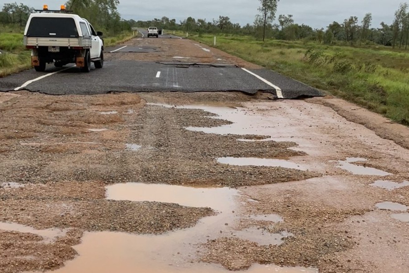
The flood damaged Barkly Highway between Mount Isa and Camooweal. (Image: DTMR)
Floodwaters are starting to slowly ease in remote Burketown and the emergency has shifted south to Urandangi, with 16 people so far evacuated as water levels start to rise.
Air assets are stationed nearby and on standby for emergency rescues and transport of food, water and medical supplies, Senior Sergeant Adrian Rieck from the Mount Isa District Disaster Coordination Centre said.
“Water reserves and food supplies are good, and resupply continues. Telstra Services have also been restored to the area,” he said.
Almost 100 residents were evacuated in remote Burketown at the weekend after river levels exceeded seven metres, surpassing the 2011 record of 6.78 metres.
Thirty-seven houses had power disconnected as they were inundated in floodwaters, while about 70 residents remained in the area with limited electricity and water supplies.
Conditions are still too dangerous for residents to return with authorities urging them to limit movement in the floodwater due to unseen hazards and recent crocodile sightings.
The Barkly Highway between Mount Isa and Camooweal is closed due to significant flood damage.
“We’re working as quickly as we can to repair the highway but serious flooding is slowing efforts,” the Department of the Transport and Main Roads said in a statement.
“At this stage, we’re not anticipating access will be restored to Camooweal via Mount Isa until late next week.”
Burke Shire mayor Ernie Camp said water levels had dropped about 400mm on Monday morning, bringing some positive news for the flood-ravaged region.
Camp said about 100 people had been evacuated from the town itself, and another 120 across the shire.
“Quite big numbers considering the shire population in Burketown, so a considerable amount of our citizens are now in neighbouring shires or towns and cities,” he told ABC News Breakfast on Monday.
He said parts of the town had stayed relatively high and dry, but it would be some time before the full extent of the damage would be understood.
“Those who are fit and healthy, we’d love to see them back in the next two weeks, but those who may have some medical conditions, please stay where you are,” Cr Camp said.
Severe flooding is continuing along the Gregory, Nicholson and Leichhardt river catchments, which recorded up to 35mm of rain in the 24 hours to Sunday morning.
A major flood warning is also active in the lower Flinders and Cloncurry rivers.
The Gregory River peaked at 12.3 metres and was falling on Monday morning, although it remained at major flood level.
With more showers and isolated thunderstorms forecast for the state’s northwest, emergency services expect peak flooding to continue.
Queensland Emergency Services Minister Mark Ryan said there was extensive damage in the state’s northwest after daily rainfall reached in excess of 300mm.
“This has caused significant damage to road infrastructure, with large washouts and ground saturation triggering the closure of a number of roads,” he said.
On Sunday, the federal and state governments announced more disaster funding, including payments for Urandangi residents of up to $180 for individuals or $900 for families to cover personal essentials.
In Burke, Carpentaria, Cloncurry, Doomadgee, Mornington and Mount Isa, loans of up to $250,000 are being made available for affected small businesses and primary producers.
-with AAP